Baseline Studies Summary
The objectives of the environmental baseline studies for 2022 were to:
- Obtain additional information on the natural environment and baseline conditions in the study area through a combination of desktop review and field verification where necessary.
- Identify and provide details on environmental sensitivities in support of the EIA process.
- Provide reports on the scope of works carried out with intention to build the foundation of baseline reports for the EIA process.
Baseline studies for 2022 comprised what have been identified as Valued Components, namely: ecosystems (ecological assessment, terrestrial and aquatic habitat), fish habitat, birds and amphibians, hydrology, water quality and noise. The results of these studies for 2022 are presented in this final baseline report, which is an independent report. This is the continuation of the 2021 Early Baseline Studies, the results for which have also been included.
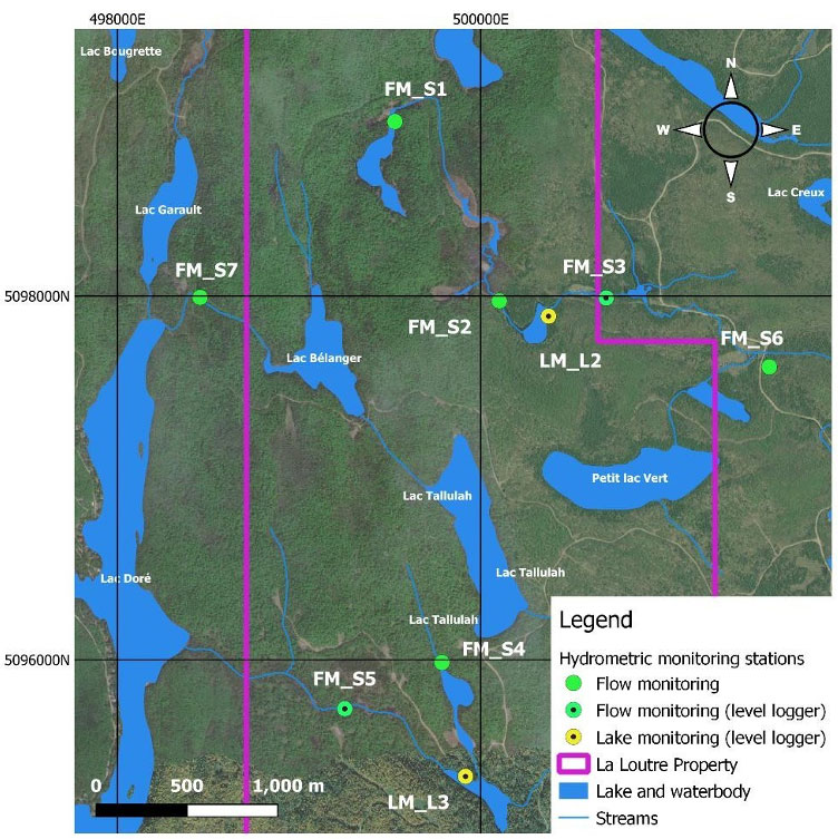
A combined terrestrial and aquatics baseline study was conducted for the development of Lomiko’s La Loutre project, where an Ecological Land Classification exercise was undertaken, in parallel with a desk-top assessment of potential occurrences of species at risk in the study area. An aquatic habitat characterization was conducted to understand the status of the natural aquatic environment and to provide an overview of the existing conditions within the study of the proposed graphite flake mine. Furthermore, benthic invertebrate community and fisheries studies were conducted in watercourses that are in close proximity to the proposed mine footprint. Hydrometric data such as water level, flow velocity, and river profile data at eight (8) hydrometric stations were measured monthly starting in April 2022; these data were collected to characterize hydrological variation of the streams and lakes within the study area. A total of eleven water quality sampling locations have been used to collect monthly surface water samples since May 2022. Finally, baseline noise measurements were conducted in the study area using a Larson Davis 831, Class I sound level meter.
All work has been conducted in compliance with the various applicable Quebec directives, regulations, and protocols. The conclusions and recommendations contained in this report are based upon the applicable guidelines, regulations, and legislation existing at the time the report was produced.
Key Results
Noise
Situated in remote rural Quebec, the project site is largely unpopulated, consisting primarily of forested land uses. Sensitive receptors in the project area are rural residences west of the La Loutre property. During three separate baseline noise monitoring surveys, daytime noise levels ranged from 38.0 to 45.5 dBA while nighttime levels ranged from 22.5 to 45.8 dBA. Existing noise levels are typical for a remote rural area and reflects the influence of local wildlife and weather. Based on provincial guidance, appropriate assessment sound levels for the cottage community on the western shore of Lac Dore would be 45 and 40 dBA for day and nighttime, respectively. While the appropriate assessment sound levels for the Pourvoirie Club Des Douze would be 50 and 45 dBA for day and nighttime, respectively.
Water Quality
A total of eight (8) hydrometric stations are installed at the project site (shown below) along with 11 water quality sampling stations which have been identified to collect samples and data in 2022. An additional station was added in summer to reflect the point where part of the Project site catchment flows into Lac Doré. Water quality monitoring was conducted according to the Guide d’échantillonnage à des fins d’analyses environnementales (MELCC, 2008), Guide de caractérisation physicochimique de l’état initial du milieu aquatique avant l’implantation d’un projet industriel (MELCC, 2017), Directive 2019 sur l’Industrie Minière (2012); as well as other federal and provincial guidelines.
Although there are no criteria for many of the conventional parameters of surface water quality, the results show that the concentrations fall in low ranges. For the parameters that have limiting criteria (such as alkalinity, chloride, fluoride, nitrate, ammonia nitrogen, total suspended solids, turbidity and total phosphorous), the concentrations at all stations during the monitoring period were below criteria, except for the Total alkalinity in almost all the stations and events. However, both temporal and spatial variations in concentrations of this parameter were observed during the monitoring period and would be related to background conditions. Variations of the concentrations in August, September and December could be indicative of temporally varying effect of sources throughout the year. Therefore, the water quality monitoring operations need to be continued at least over one year period and also to be investigated with further geochemical studies.
Flora and Fauna
The focus of this study was to characterize the forest environment and to identify potential species at risk (SAR) habitats through desktop review of existing data and focused field studies to fill in knowledge gaps. Ausenco ecologists conducted avian point counts at fourteen survey stations from June 7 to June 11, 2022, while Kilgour & Associates LTD biologists conducted avian point count surveys at ten stations from July 25 to July 29, 2022. A total of 51 bird species were observed and heard during the avian point count surveys. The study documented two small, forest-dwelling at-risk bird species (Canada Warbler and Olive-sided Flycatcher) within or in the vicinity of the proposed mine footprint. While there are subtle differences in the finer details of optimal nest-site location for each of the species, both species could nest within any of the adjacent forest ecosites.
Fish community assessments were conducted via electrofishing and minnow trapping during the fall of 2022 in the three watercourses sampled for benthic invertebrates where fish communities had not been previously surveyed in 2021. The fish community assessments found no invasive fish species, sport fish, nor fish species that are currently listed under the liste des espèces fauniques menacées ou vulnérables (Gouvernement du Québec, 2022) or the Species at Risk Act (Government of Canada, 2022). All fish captured are common baitfish to the Outaouais region and are all tolerant to warm waters. Furthermore, all fish caught in 2022 were the same fish species caught during the 2021 baseline studies conducted by Hemmera. The most captured fish species in the watercourses on the La Loutre Property were Northern Red Belly Dace, Fathead Minnow, and Finescale Dace, all of which are common baitfish.
What are early baseline studies and why are they important?
Lomiko hired Hemmera Envirochem Inc. to perform baseline studies of the La Loutre Graphite Project area. The study started in August 2021 and will run for four seasons or until the fall of 2022. Early baseline studies provide a broad overview of the existing conditions in the area where Lomiko proposes to develop a graphite mine.
The early studies help to understand the current status of the natural environment and to identify potential concerns and/or risks to be addressed with further studies as part of the environmental and social impact assessment (ESIA) process.
What early baseline studies were undertaken?
The baseline studies assessed current and historical conditions using a combination of publicly available data and documentation, field work, and laboratory tests. The studies included in 2021 report are based on the data collected from August until the end of December 2021:
- Geochemistry – properties of the waste rock and low-grade ore
- Hydrology – how surface water flows and changes over time
- Wetland and Hydric Environments – characterization and ecology of wetlands
- Aquatic Species and Fish Habitat – characterization of the watercourses and surveys of fish species inhabiting surface water
In addition, a review of environmental information such as geographic location, rainfall, snowfall, temperature, and elevation was completed.
What are the highlights of the studies and what information could interest the communities?
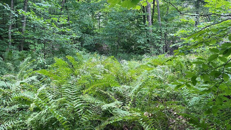
Figure 1: Wetland Area
-
- Water level, flow and velocity of river profile data were collected over four months in 2021 at the site. To supplement this information and obtain a better understanding of long-term historical trends, data from publicly available sources were acquired and reviewed.
- The La Loutre Project area has many wetlands with high ecological value.
- Publicly available data for groundwater and flood flows for different drainage areas reviewed. Further on-site measuring and monitoring of water levels will be needed to have a robust understanding of the groundwater flow.
- A groundwater characterization program is planned for 2022. Potential groundwater monitoring wells have been identified and will be used to collect groundwater samples.
- Waste rock and low-grade ore samples were taken from the La Loutre deposit and sent to a lab for geochemical analysis. Results showed that the rock is expected to remain in relatively stable geochemical condition in the short-term, however further sampling and testing is required to confirm the materials’ reactivity over time.
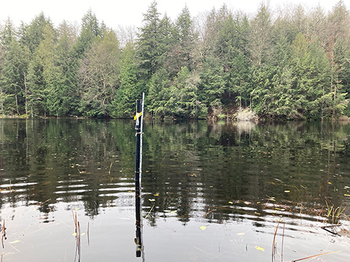
Figure 2: Location of Water Sampling Station WQ_L7
- Ten (10) surface water samples were collected monthly from August to December 2021. Surface water quality was found to be within the acceptable concentration range for most parameters with some notes for consideration:
- One sample (WQ_L7), taken from an unnamed lake south of the proposed mine, in December exceeded acceptable phosphorus levels. Total phosphorous levels can increase if fertilizer runs off into surface water with heavy rains or if there is a septic system leak. Although the exceedance only occurred once, it means that more monitoring and sampling is needed to determine the sources.
- Concentrations of Mercury (WQ_S3) were higher than acceptable levels in the August sample but returned to normal for all other samples taken in the fall. Occasional exceedance of Mercury concentration levels may be caused by disturbances in settled material or summer changes in inverted water levels. High concentration is a concern for the long-term protection of terrestrial wildlife and aquatic life. However, it should be noted that the long-term acute aquatic life protection criteria are considerably higher. More monitoring and sampling over 12 months will be undertaken to further document natural changes in the water quality of the lakes and watercourses.
- Concentrations of Iron (WQ_S3), Manganese (WQ_S3), Aluminium (WQ_S7), and Lead (WQ_L1 and WQ_L7) above the acceptable range for long-term aquatic life protection were also detected at respective stations in December despite low flows. The concentration of these minerals may vary depending on the surface conditions and sedimentation following storm events.
- Concentrations of iron and manganese were also detected at one location but pose no concern.
What happens next?
More detailed and localized baseline studies will take place in 2022. Baseline studies information will be used to document seasonal variation in the natural environment where La Loutre project is located.
The data obtained during the four seasons of the studies will be used in the ESIA process as well as the site design of the mine to inform how the proposed mine can be built and operated in a way that avoids or reduces potential impacts on the environment and surrounding community.
Click here for the Noise Monitoring Report Summary
Click here for the January 2026 dust monitoring report
Click here for the full baseline studies report
Click here to see 2025 environmental survey methodology. (Document is in French)
Click here for all water quality data collected since 2021
2022 Noise Monitoring and Future Commitments
Background on Study and Noise Level Regulations
Between September 7-12, 2022, Lomiko Metals conducted a multi-point noise monitoring survey at their La Loutre property in the Outaouais region of southern Quebec. The purpose of this survey was to evaluate the potential impact of noise produced from exploratory infill drilling on the nearby cottager community at Lac-Doré. One noise monitoring station was installed at the project site where a single VD5000 drill was in operation. The second monitoring station was installed at a resident’s cottage at Lac-Doré. Lomiko mandated Soft dB to analyze and review the measurements and sound monitoring practices carried out by Lomiko and to provide recommendations for future noise monitoring activities.
The table below presents a scale of the subjective perception of noise levels as issued and referred in the regulations. This scale is used to better represent the sound levels presented in this study.
| Level | Perceived impression |
| 140 dB | Pain threshold |
| 130 dB | |
| 120 dB | Painful |
| 110 dB | Unsupportable |
| 100 dB | Hardly supportable |
| 90 dB | Very noisy |
| 80 dB | Noisy |
| 70 dB | |
| 60 dB | Common noise |
| 50 dB | |
| 40 dB | Low |
| 30 dB | Quiet |
| 20 dB | Very quiet |
| 10 dB | Silent |
| 0 dB | Inaudible |
The MELCCFP NI98-01 sets the maximum noise level according to the zoning category. These maximum allowable noise levels are presented in the table below.
| Zoning | Description | Night [dB(A)] | Day [dB(A)] |
| I | Residential | 40 or residual sound | 45 or residual sound |
| II | Multiple units | 45 or residual sound | 50 or residual sound |
| III | Commercial uses | 50 or residual sound | 55 or residual sound |
| IV | Industrial | 70 or residual sound | 70 or residual sound |
| Period | 19h à 7h | 7h à 19 h | |
Results
The table below presents the recorded noise levels from both installed noise monitoring devices (Larson Davis 831Cs) for the duration of the study period. The raw (unprocessed) sound levels are calculated on an hourly basis.
| Date | 07-sept | 08-sept | 09-sept | 10-sept | 11-sept | 12-sept | ||||||
| Site | Cottages | Drill | Cottages | Drill | Cottages | Drill | Cottages | Drill | Cottages | Drill | Cottages | Drill |
| 00:00:00 | 32 | 33 | 33 | 26 | 32 | 29 | 32 | 30 | 34 | |||
| 01:00:00 | 30 | 30 | 32 | 32 | 32 | 26 | 32 | 27 | 32 | |||
| 02:00:00 | 29 | 30 | 31 | 34 | 31 | 25 | 31 | 27 | 32 | |||
| 03:00:00 | 30 | 30 | 31 | 30 | 30 | 26 | 29 | 30 | 32 | |||
| 04:00:00 | 29 | 31 | 29 | 34 | 30 | 23 | 29 | 29 | ||||
| 05:00:00 | 27 | 31 | 29 | 45 | 28 | 23 | 28 | 44 | ||||
| 06:00:00 | 29 | 46 | 29 | 44 | 30 | 46 | 28 | 40 | ||||
| 07:00:00 | 43 | 33 | 34 | 40 | 31 | 28 | 31 | 30 | ||||
| 08:00:00 | 35 | 34 | 43 | 34 | 32 | 27 | 34 | 33 | ||||
| 09:00:00 | 43 | 31 | 47 | 30 | 35 | 34 | 32 | 35 | ||||
| 10:00:00 | 37 | 32 | 43 | 32 | 32 | 35 | 35 | 33 | ||||
| 11:00:00 | 37 | 52 | 32 | 33 | 37 | 34 | 36 | 34 | 35 | |||
| 12:00:00 | 34 | 47 | 32 | 33 | 38 | 37 | 35 | 37 | 37 | |||
| 13:00:00 | 36 | 37 | 45 | 36 | 35 | 37 | 35 | 40 | 37 | 34 | ||
| 14:00:00 | 46 | 38 | 50 | 36 | 38 | 39 | 36 | 43 | 38 | 34 | ||
| 15:00:00 | 43 | 44 | 44 | 38 | 38 | 41 | 39 | 38 | 38 | 36 | ||
| 16:00:00 | 36 | 44 | 53 | 37 | 40 | 40 | 37 | 39 | 37 | 31 | ||
| 17:00:00 | 36 | 44 | 44 | 41 | 36 | 43 | 42 | 44 | 34 | 41 | ||
| 18:00:00 | 35 | 42 | 47 | 41 | 35 | 41 | 35 | 42 | 33 | 50 | ||
| 19:00:00 | 34 | 40 | 34 | 34 | 35 | 31 | 33 | 34 | 31 | 48 | ||
| 20:00:00 | 36 | 32 | 35 | 34 | 34 | 30 | 36 | 34 | 34 | 29 | ||
| 21:00:00 | 36 | 32 | 36 | 36 | 35 | 30 | 36 | 30 | 35 | |||
| 22:00:00 | 37 | 33 | 35 | 34 | 34 | 30 | 35 | 34 | 35 | |||
| 23:00:00 | 32 | 32 | 35 | 28 | 33 | 29 | 34 | 29 | 34 | |||
Observations
- For most of the measured periods, both day and night, the levels are well below the NI98-01 targets. This means that the background noise in the area is generally low.
- For most sound recordings at the residences, sound sources are identified to be human activities – road traffic, electrical equipment, wildlife and aircraft noise. The background noise is higher in the residential sector; it is possible to hear electrical noise (tonal hum).
- For most of the drill recordings, the sources are associated with wildlife or what seems to be trucking.
- Drill demobilization was completed on September 11th, 2022. On September 12th , background noise levels are back to lower levels. For such low measured levels, it is possible that the background noise threshold of the microphones is reached. However, this behavior is not observable at the residence level (slight fluctuations in levels).
Recommendations and Commitments for Future Work
Any future monitoring should be accompanied by continuous audio soundtrack recording to allow listening to the environmental sounds and evaluate the impact of noise produced by activities at the project site. In future work, it is also recommended that continuous noise monitoring be carried out in the community. Noise impact modeling should also be conducted to produce sound maps that illustrate how sound propagates through the local topography and environment to identify the most at-risk receptors. This will promote optimal placement for sound monitoring stations. As the background noise in the area is very low, it is possible the actual environmental noise levels are below the lowest detection limit of the sound meter used. It is recommended to utilize a more sensitive noise meter for future studies, equipped with a weather station. Finally, a follow-up plan should be established to ensure that any noise complaints are monitored and mitigated appropriately.
RECLAMATION PLAN
Learn more about Lomiko’s proposed reclamation plans for the La Loutre site after mining operations have been completed.