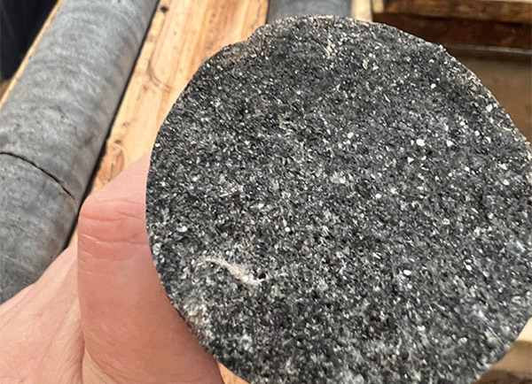
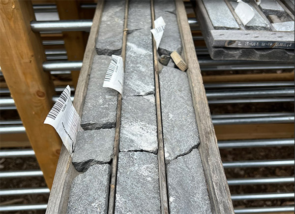
The Bourier project consists of 203 claims for a total ground position of 10,252.20 hectares (102.52 km2) in a region of Quebec that boasts other lithium deposits and known lithium mineralization, as shown in the maps and table below. The lithium pegmatites tend to occur in swarms in the volcano-sedimentary units, and the Bourier property covers a large part of this regional volcano-sedimentary unit, which also hosts Nemaska Lithium’s Whabouchi deposit and Critical Elements’ Lemare showing.
Lomiko and Critical Elements Lithium Corporation mandated GoldSpot Discoveries Corp. in the summer of 2021 to conduct a remote targeting process for lithium, on the Bourier claims within the Nemiscau belt (see Figure 1 below). GoldSpot Discoveries Corp.’s proprietary approach of Artificial Intelligence (AI) and geological interpretation highlighted lithium potential at Bourier claims (see Figure 2 below) within the Nemiscau greenstone belt. This process has outlined a total of 15 high to moderate prospective lithium targets were identified.
Preliminary Summer 2021 field exploration results have revealed the discovery of five new sectors of spodumene-rich (Li) pegmatites, highlighting the potential of the Bourier project.
The compilation of discrete outcrop observations allowed a reliable update to existing geologic maps, resulting in a refined lithium exploration-oriented pegmatite map. A total of 99 pegmatite bodies were added to the current geological map, highlighting previously unknown potential for economic lithium mineralization.
An up-to-date structural interpretation was created based on a high-resolution aeromagnetic survey commissioned by Critical Elements. This survey revealed structurally complex patterns, including large-scale folds and major ENE-trending ductile fault zones.
GoldSpot generated lithium targets using a knowledge-based approach with Artificial Intelligence (AI) data-driven methods. The AI data analysis trains machine learning algorithms to predict the presence of lithium using all variables (features), both numeric and interpreted on a 10 x 10 m grid cell datacube. Once the model performs to a satisfactory level it is able to produce:
- a series of zones with relatively high probability of containing lithium;
- a ranking of feature importance for each input feature.
Prior to heading into the field to conduct surveys and test the algorithms GoldSpot prepared a map of probable outcrop zones, resulting from the AI analysis on high-resolution satellite imagery. The machine learning-assisted outcrop detection allows for time- and cost-efficient field exploration.
An exploration crew composed of Critical Elements’ and GoldSpot’s geoscientists conducted a 20-day prospecting program at the Bourier project, with focus on the high to moderate lithium targets generated by GoldSpot. The highlights of this program include the discovery of five new sectors of spodumene-rich (Li) pegmatite (laboratory analysis results are pending; Figure 2). These discoveries were made within, or the extension, of GoldSpot’s targets.

Figure 1: Location of Critical Elements’ projects, Eeyou Istchee, James Bay, Québec. Critical Elements and Lomiko Metals’ Bourier project on the Northeastern part of the Nemiscau belt.